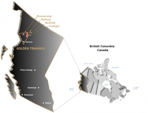
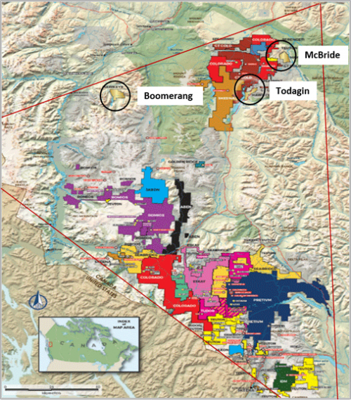
In June of 2022 Hawkeye closed upon the sale of its Boomerang property (“Property) which included the sale of its McBride, Railway and Todagin properties to Newcrest Red Chris Mining Ltd. (“Newcrest”), a wholly-owned subsidiary of Newcrest Mining Limited (Australian Stock Exchange: NCM, Toronto Stock Exchange: NCM, Papua New Guinea Exchange: NCM), for total consideration of CAD$1,400,000 for all four properties. Under terms of the Asset Purchase Agreement Hawkeye will retain a 2% Net Smelter Royalty (NSR) on the Boomerang property which is subject to buy-down provisions. For details on these provisions please click on the ROYALTIES link above.
The Boomerang Project
The Boomerang Project is situated directly south of Telegraph Creek, BC, and northeast of Yehiniko Lake which drains north on Yehiniko Creek to the Stikine River. The claims are transected by Boomerang Creek in the south and another unnamed creek in the north, both of which contain numerous peripheral drainages from a major WNW-oriented topographic high following the Hazelton Group geology.
The Property is situated in the northwestern section of the Golden Triangle, positioned approximately 25 kilometres northwest of Teck and Copper Fox’s Schaft Creek deposit and 50 kilometres north of the Galore Creek deposit held by Teck and Novagold.
The Boomerang Project is an area that has seen very limited exploration. Groupings of claims located several
kilometres to the west and southwest of Yehiniko Lake have been the principal areas of focus for gold and copper exploration reported since the 1970’s.
The 1988 regional stream geochemistry indicates numerous priority drainage targets on the Boomerang Project based upon the identification of multiple anomalies with >98th percentile gold values, and corresponding base and heavy metal pathfinder elements.
Similar to the McBride and Todagin properties and those held by Newmont Mining (GT Gold) in the northeastern section of the Golden Triangle, the principal geological units underlying the claims comprise the Hazelton and Stuhini Groups with precious and base metal mineralization commonly associated with structural controls or porphyry systems within and adjacent to intrusions. The Jurassic-age Hazelton basalt, andesite, dacite and rhyolite flows and pyroclastics unconformably overlie Upper Triassic Stuhini volcanics and volcanoclastic deposits. Both Stuhini and Hazelton lithologies are underlain by Mid to Late Triassic quartz diorite intrusions and the volcanic deposits occur as outliers bounded in large part by these intrusions. Hazelton and Stuhini rocks are intruded by Early to Mid-Jurassic plutons comprising the Cone Mountain granodiorite and the Three Sisters tonalite. Coarse clastic sediments of Cretaceous to Paleocene age overlie the Hazelton and Stuhini to the south and west on the Property.
“Assay values referred to on this page have been referenced from historical programs. Values in these old reports have been verified by the Qualified Person, but there has not been any onsite data collection to confirm them. As such these values should be regarded as a guide only. “


